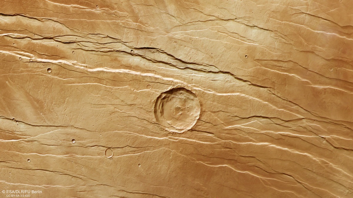
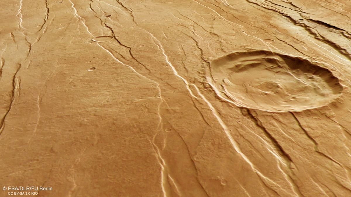
Scratches and grooves on the Martian surface look like a huge ‘fingernail’ was gouging out regolith on the Red Planet, but there’s a volcanic origin to these features.
Specifically, scientists believe that these faults, dubbed Tantalus Fossae, were created by the volcano Alba Mons, which is located to the west of the terrain visible in the striking new views. The images are based on data gathered by the European Space Agency’s (ESA) Mars Express mission, which has been orbiting Mars since 2003.
Those intriguing gouges around the flanks of Alba Mons are known as grabens, which formed as the mountain grew, ESA officials wrote in a statement about the images. As volcanic activity pulled at the Martian surface, parallel fault lines opened up circling the peak; the rock between them dropped into the empty space this created, agency officials explained — like geologic stretch marks
The grabens stretch in an “incomplete ring” around Alba Mons, ESA noted, for a total length of 620 miles (1,000 kilometers). In some places, the grabens are as deep as 1,150 feet (350 meters), more than three times the height of the Statue of Liberty.
Related: Martian crater looks just like a human fingerprint in this incredible new image
According to ESA, the faults on display in the new images likely formed one by one over a long period of geological activity, not simultaneously.
Scientists in part generate that timeline by comparing the grabens with other features in the region. For example, a large crater that forming the centerpiece of one image has grabens on top of it — which shows the crater must have been there first. Also, smaller “branching” valleys cutting through the grabens are assumed to be older.
Alba Mons is roughly 22,000 feet (6.8 km) tall. Compared to its neighbor, the gigantic Olympus Mons, Alba Mons has gentler slopes and a much lower elevation. That said, Alba Mons is comparable in height to Earth’s Mount Everest, which stands at nearly 29,000 feet (8.8 km.)

Mars Express has been examining Mars since 2003 and acquired the new imagery using its High Resolution Stereo Camera. According to ESA, the mission has charted odd features on the Red Planet’s surface, such as tectonic faults and river channels, throughout its mission in a long-standing investigation to chronicle Martian history.
A 2006 Journal of Geophysical Research paper — which uses an alternate name for the volcano, Alba Patera, that emphasizes the collapsed summit — suggests its volcanic deposits date to the Amazonian period. That period of slow-scale change, according to ESA, started roughly 2.9 billion years ago and continues to today.
Follow Elizabeth Howell on Twitter @howellspace. Follow us on Twitter @Spacedotcom or Facebook.


More Stories
Elopement Videography: Locations, Costs, and Why Couples Elope
THIRD TIME LUCKY FOR THIS MAGICAL DRUMTOCHTY WEDDING DAY!
5 Tips on Starting a Business in 2022 – Virginia Wedding Photographer